SVC 02
RGB Mapping & Orthomosaics
A current, measurable, centimeter-accurate picture of the whole place
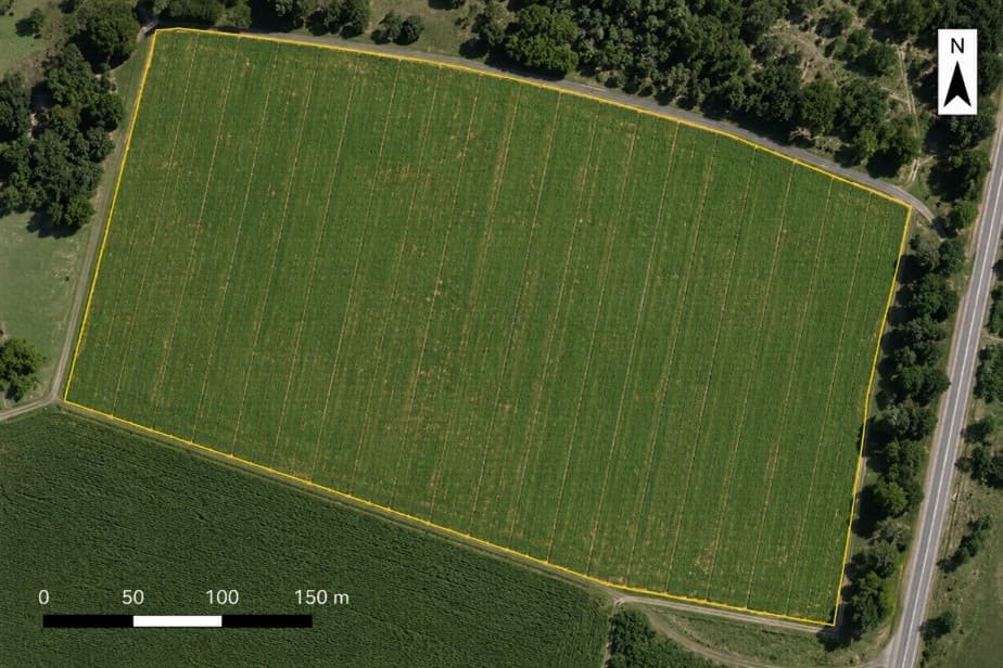
An orthomosaic is hundreds of overlapping photos stitched into one geometrically corrected image — so unlike a satellite view or a photo out a truck window, you can measure distance and area directly off it. At the altitude we fly, ground resolution runs under an inch per pixel: individual plants, washouts, and gaps are all visible.
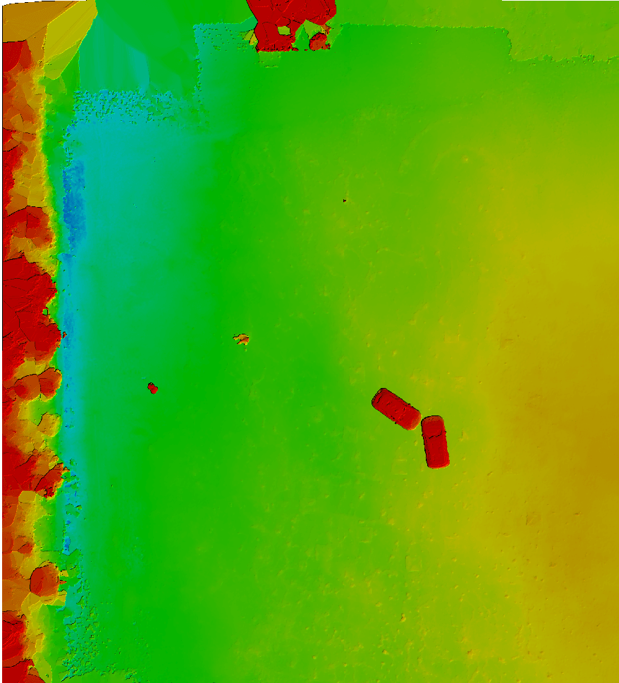
Add the digital surface model and you get elevation across the field. That's what shows you where water actually goes — the low spot drowning your stand, the terrace that isn't carrying anymore, the grade a drainage contractor needs before he quotes you.
Everything is georeferenced, so an orthomosaic flown after a storm is directly comparable to one flown before it. That makes it real documentation for insurance adjusters, landlords, and NRCS paperwork.
Who this is for
Anyone who needs an accurate, current, measurable picture of their ground — for planning, for a claim, for a lender, or for a contractor's bid.
Year-round, weather permitting. Damage documentation flights get same-week priority.
Ready to put a pilot on your fields?
Quotes are free, straight, and same-day. Tell us what you're up against.